
Landicia Software
£149a month
Monthly rolling. Cancel any time.
All the data a solo developer or small team needs, from brownfield sites to the constraints that decide whether a site is worth chasing.
Find development opportunities, check ownership and planning, and contact landowners. Keep the research and follow-up together in Landicia.
£149 a month · Personal onboarding included
Over 25,000,000 data points across these data sources







Two ways to use it
The data isn’t the hard part. Finding the handful of sites worth a letter is, and that usually means hours of scrolling maps and cross-checking registers. Landicia narrows it down on your area from day one. Or hand us the brief, and we’ll do the searching and bring you the shortlist.
£149a month
Monthly rolling. Cancel any time.
All the data a solo developer or small team needs, from brownfield sites to the constraints that decide whether a site is worth chasing.
£350a month
Monthly rolling. Cancel any time. Full Landicia access included.
All of Landicia, plus us working your brief alongside you. You get up to 20 matched opportunities a month and help getting further with the ones worth pursuing.
We take on a limited number of briefs at a time.
Explore a site
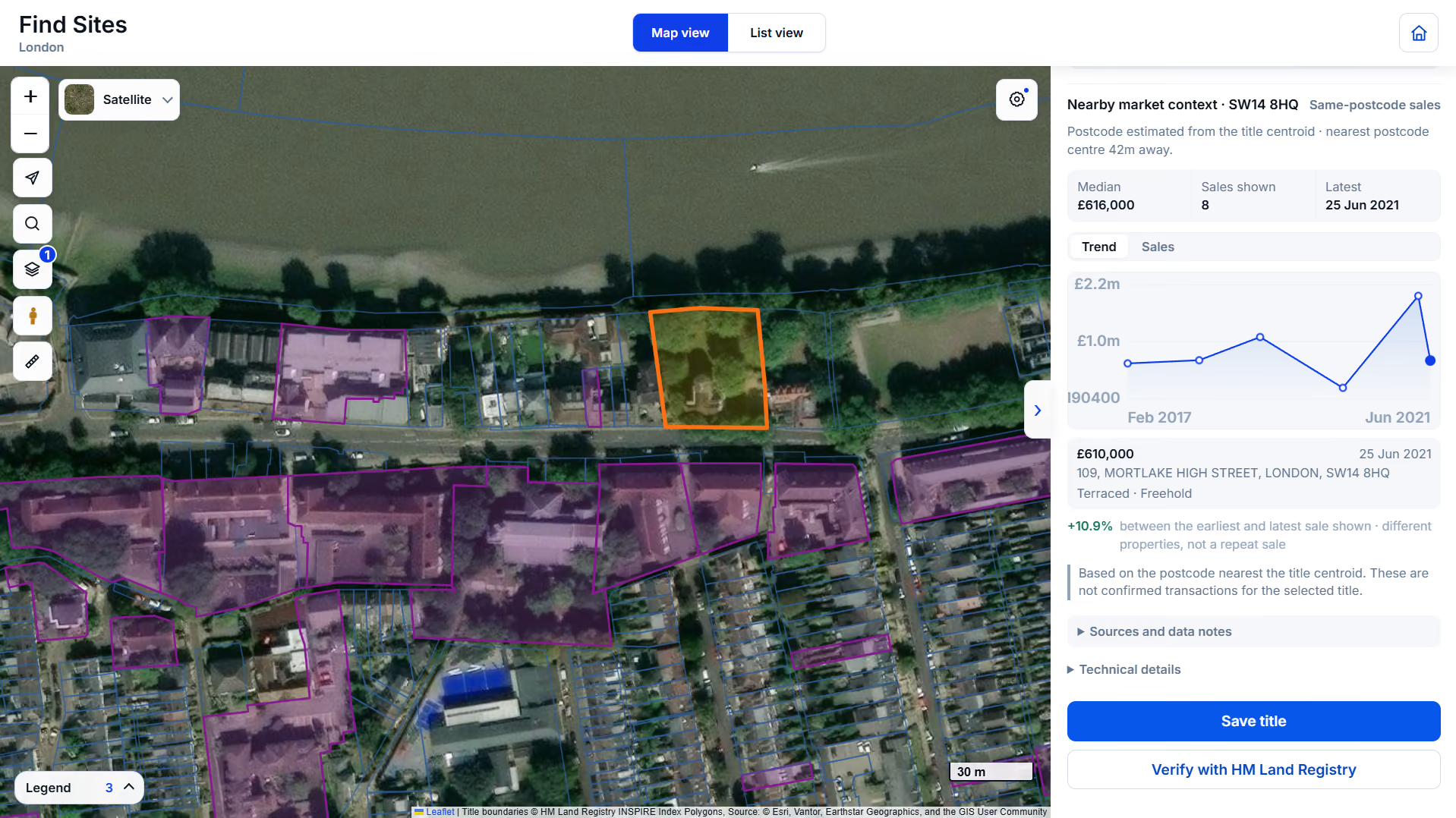
Select an example marked site to see ownership, planning history and nearby sales.
The workflow
Save your research as you go. Ownership checks, letters and follow-ups stay attached to the site, ready for the next step.
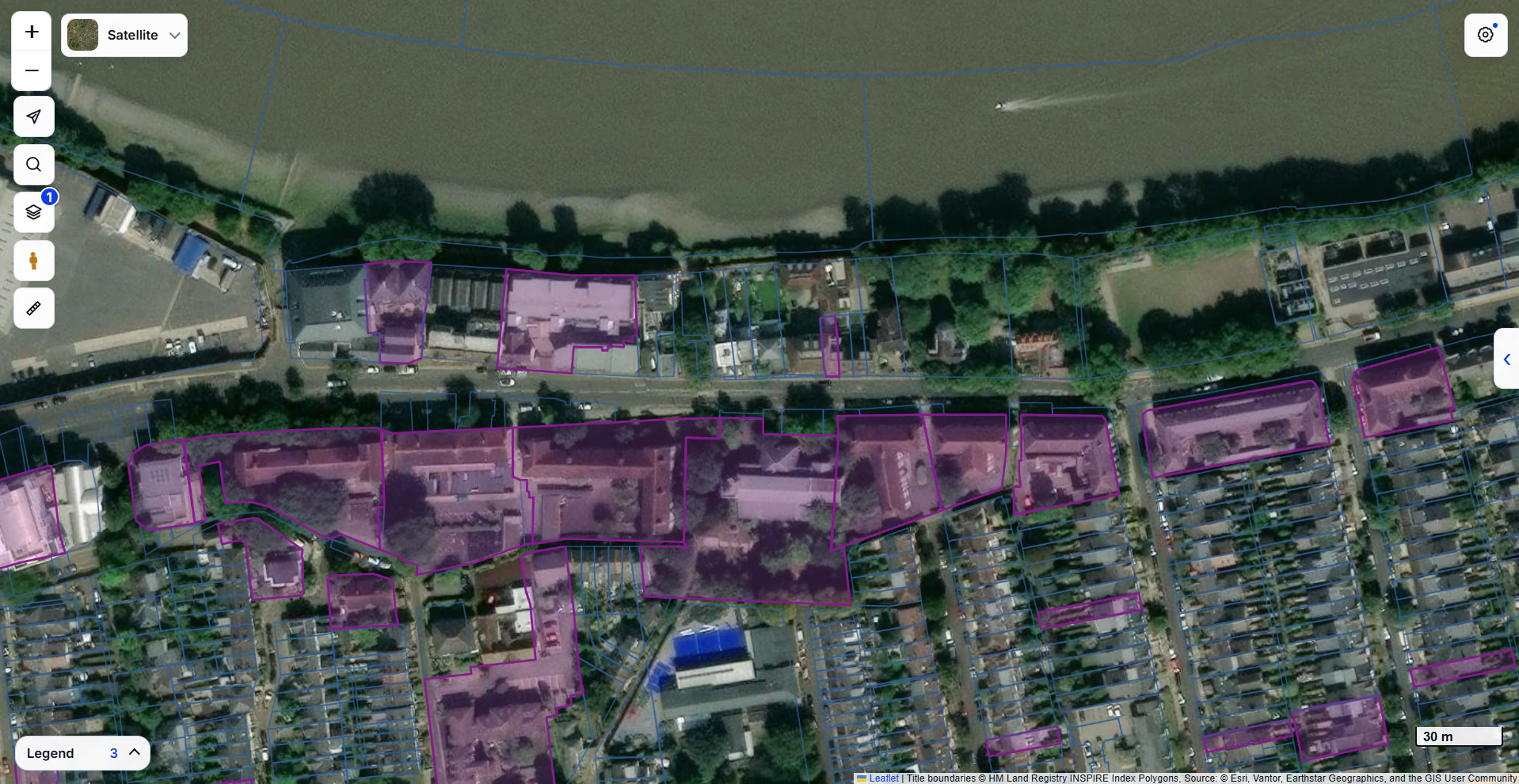
Set a search area and Landicia surfaces brownfield and commercial development opportunities from official registers, plotted with the planning context around them.
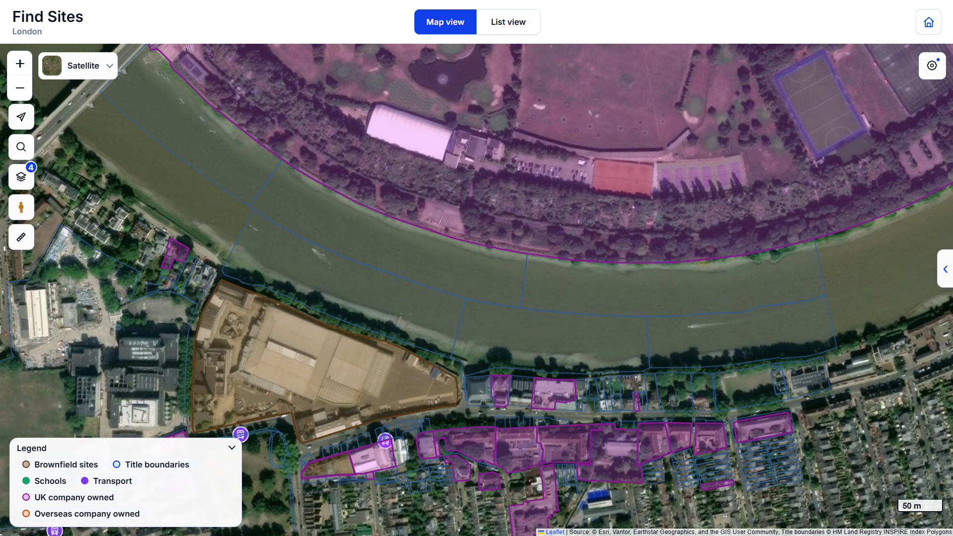
Map view and list view of the same search area.
Toggle constraint and planning layers to see what shapes the site: flood zones, green belt, conservation areas, listed buildings and tree preservation orders.
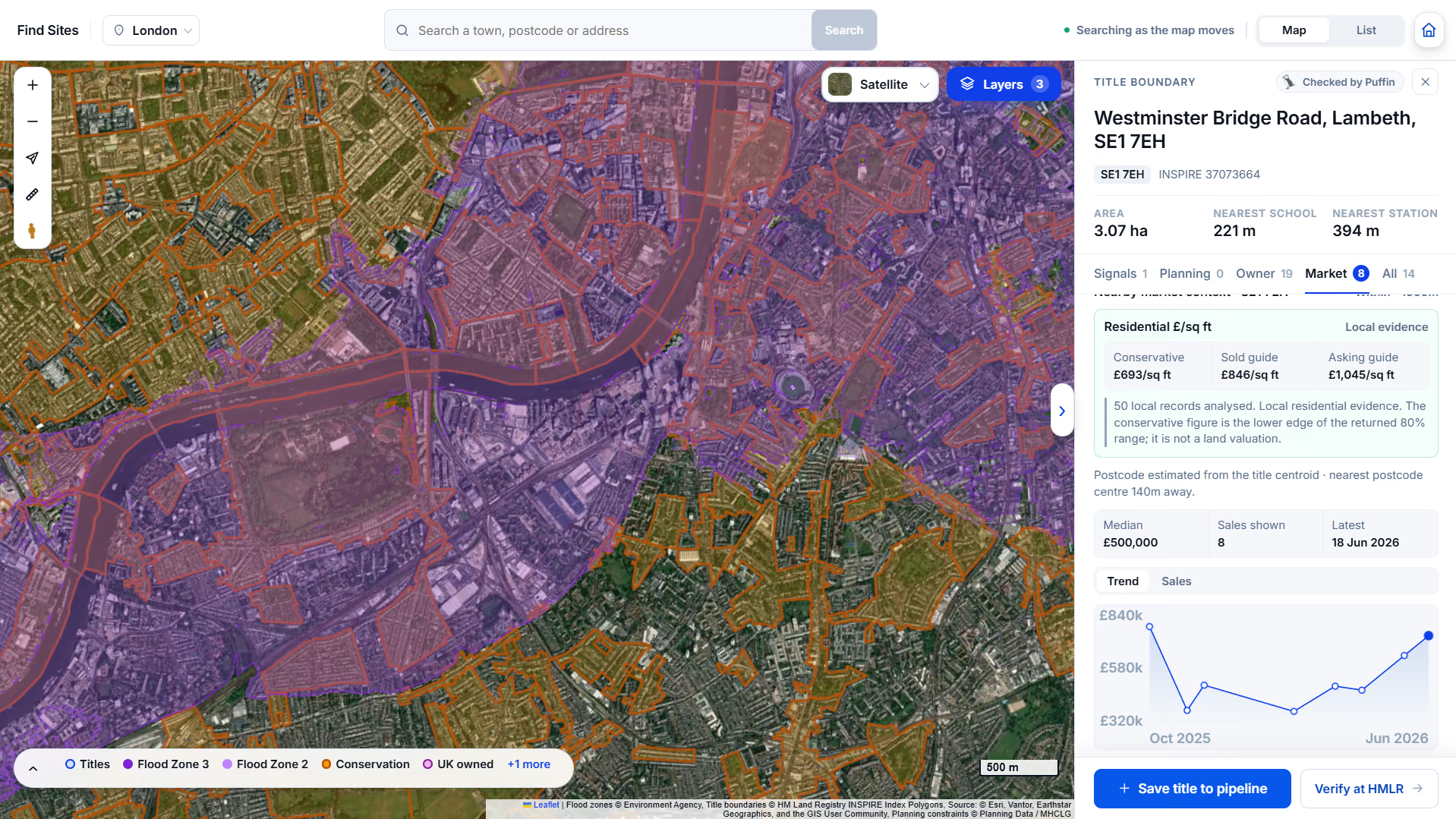
Constraints and market evidence read together, on one title.
Select a title boundary to open its record: planning history on and around the title, sale evidence per square foot, then prepared references into the official HM Land Registry search.
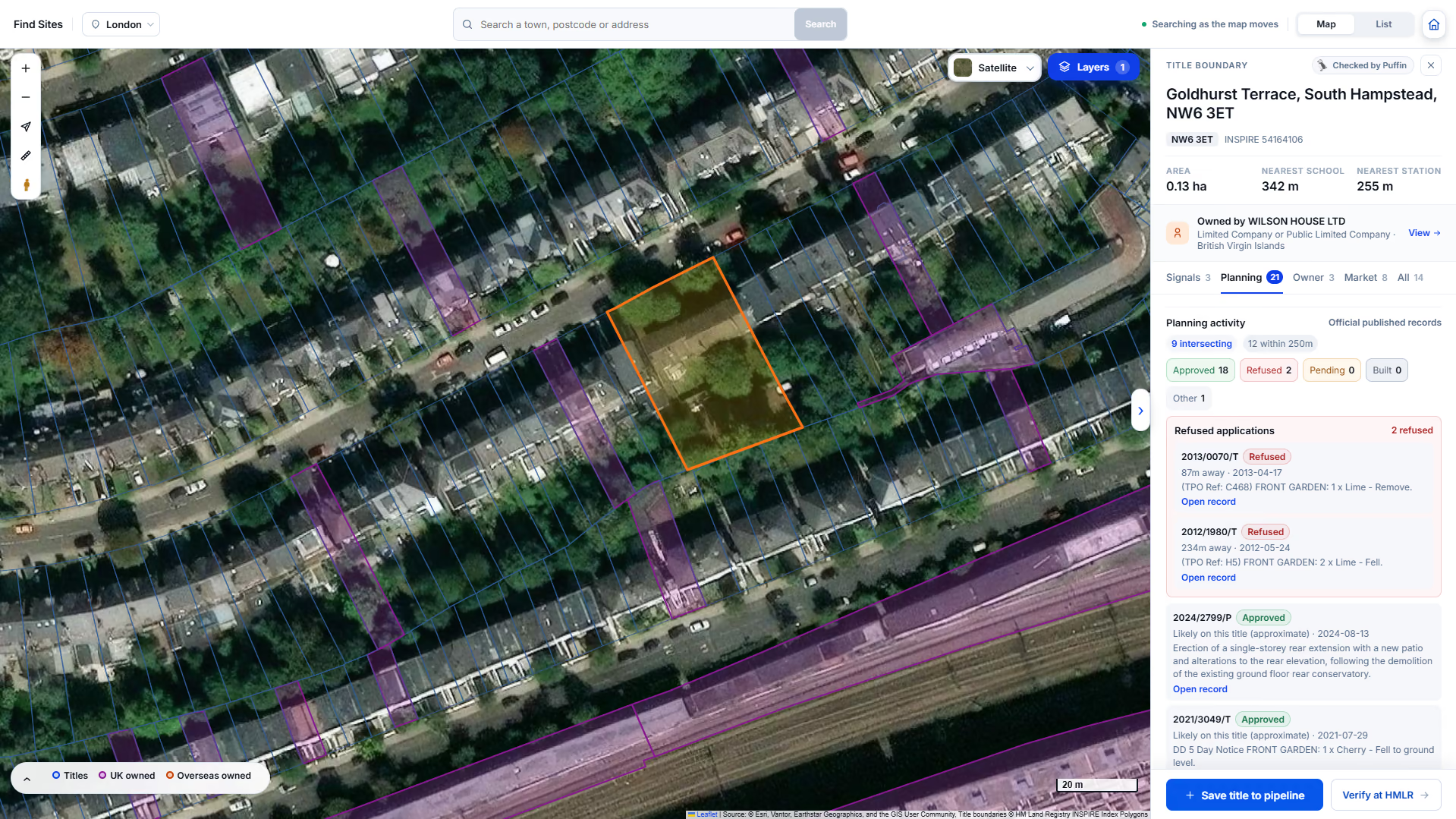
Owner, planning history and the INSPIRE reference on one record.
The For you tab holds sites we have put forward, each with a Landicia appraisal of what has been applied for and decided. Review the evidence, then save the ones you want to keep.
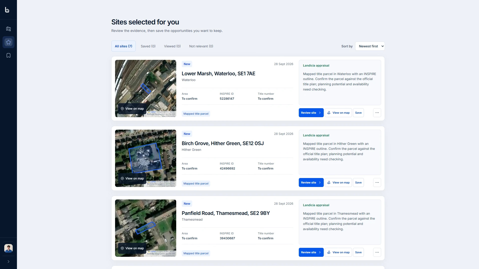
Each selected site comes with its area, INSPIRE reference and an appraisal.
Saved sites sit together in My Sites. Group them, mark the ones you are pursuing, and send letters from the site record, printed locally or posted through Landicia. Owner responses are recorded on each site.
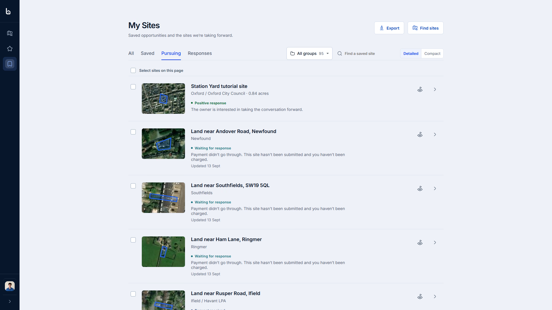
Saved, pursuing and responses, with groups across every saved site.

Landicia is straightforward to use and the brownfield site search makes it much easier to identify potential development opportunities. The training has been clear and whenever I’ve suggested improvements, they’ve been acted on quickly.”
Matthew Goodman
Director, MJG Developments

A 15-minute demo
Tell us the town or county. We’ll load it before the call, then look through the search results and open a site with you.
Your target area
Start with the places you’re actively looking.
Potential sites
Review brownfield and commercial search results.
The next checks
Open ownership, planning and constraints on a site.